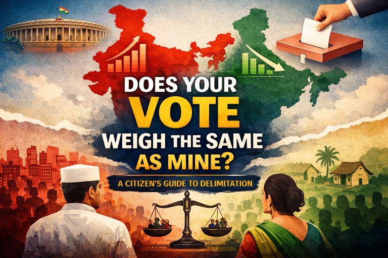
Imagine two voters in India. One lives in Kerala and the other in Bihar. Both cast a vote in the same general election, but while the Kerala voter’s MP represents 18 to 20 lakh people, the Bihar MP is responsible for over 30 lakh. Suddenly, your single vote feels very different depending on where you live. This is the world of delimitation, a process that seems technical but actually shapes the very value of every vote in the country.
Why Does Delimitation Stir So Much Debate in India?
Delimitation is essentially about drawing or redrawing the boundaries of electoral constituencies and deciding how many representatives each state gets in Parliament. The idea is simple on paper: each constituency should ideally have roughly the same number of people so that every citizen’s vote carries equal weight. But as you can imagine, reality is never that neat. India’s population doesn’t grow evenly. Some states, especially in the north, have surged ahead in numbers, while others in the south have stabilized thanks to successful family planning and other developmental measures. This creates a tension: if seats were redistributed strictly according to population, southern states would lose representation while northern states would gain. That’s why delimitation is not just technical; it’s deeply political and sensitive.
What Does the Constitution Say and Why Should It Matter to You?
The Constitution tries to manage this complexity. Articles 81, 82, 170, 330, and 332 lay out how constituencies are allocated and adjusted after every census. In theory, delimitation should happen every ten years, in sync with the decennial census. This ensures population parity across constituencies, both within and across states. But in practice, the process has been frozen several times, first after the 42nd Amendment in 1976, which froze allocation based on the 1971 census, and later through the 84th Amendment, delaying further delimitation until 2026. For the common citizen, this means that your vote might be weighed differently than someone else just because your state’s population grew faster or slower than another (Constitution of India).
Delimitation isn’t just about numbers on paper. The way constituencies are drawn has real-life consequences. Urban areas have ballooned, with people moving from villages to cities for jobs or education. This leads to huge urban constituencies and smaller rural ones, creating a mismatch in representation. Northern states, with higher population growth, now see MPs representing far more people than those in southern states. The “people to representative ratio” has almost doubled in some places in between the 3rd and 4th delimitation exercise itself (Alam, The India Forum,2024).
This widening imbalance leads to what experts call malapportionment (IFES, Boundary Delimitation, Handle). It happens when constituencies vary sharply in population size, making one representative speak for many more people than another. As a result, a voter in a smaller constituency ends up having more influence than someone in a much larger one. And even when no one is intentionally tweaking boundaries, passive malapportionment quietly builds up over time. When delimitation is delayed for decades, natural population shifts create the same distortion, leaving some MPs stretched thin while others represent comparatively fewer people.
The consequences go beyond fairness. MPs are expected to perform “constituency service,” which includes addressing grievances, educating voters, and facilitating development work. When an MP represents 30 lakh people instead of 18 lakh, keeping up with these expectations becomes practically impossible. Northern MPs face an overwhelming workload, while southern MPs might find their influence diluted if redistribution were done purely based on population.
How Do Other Countries Get Delimitation Right?
So how do other countries handle delimitation? The United States allows politicians to draw electoral boundaries, often leading to “gerrymandering”, a practice where constituency boundaries are deliberately manipulated to favor a particular political party or group. In contrast, the UK, Australia, Canada, and several Commonwealth and African nations rely on independent, neutral boundary commissions to avoid political bias. Even in Kenya, malapportioned constituencies historically favored certain regions and parties, highlighting the dangers of uneven representation. Key principles globally include impartiality, equality, representational, non-discrimination, and transparency (IFES, Boundary Delimitation, Handley).
What Are We Missing in the Delimitation Conversation?
A perspective often overlooked in mainstream coverage is how delimitation affects inter-state and urban-rural disparities. The ratio of people to representatives varies dramatically. Even in the absence of active manipulation, simply not redrawing boundaries leads to passive malapportionment. These nuances shape political power and the quality of constituency service, but rarely make headlines.
So What Can Be Done?
A spectrum of solutions has been proposed. One is to strictly follow population parity, letting each state get seats based on its share of the population. While constitutionally sound, it risks angering southern states that worked to control population growth. Another is to maintain the status quo until population growth equalizes, but this delays fair representation and ignores constitutional principles. A middle path is to expand the Lok Sabha so no state loses current seats while distributing additional ones based on population. Complementing this, the Rajya Sabha could be restructured to compensate states losing influence in the lower house, potentially by equalizing seats or using a weighted formula. Another proposal is splitting large states, like Uttar Pradesh, to better manage representation. Each solution has pros and cons, but collectively they offer a way to respect fairness while addressing political sensitivities (Alam, The India Forum, 2024).
India also has a framework for an independent delimitation authority. The Delimitation Commission consists of a Supreme Court judge,appointed by the central government, the Chief Election Commissioner or a nominee, and the State Election Commissioner of the concerned state (Delimitation Act, 2002). This body is designed to operate without political interference, echoing global best practices. Public consultation is recommended to improve transparency, though with India’s massive population, this could create logistical challenges and delays.
Conclusion
In the end, delimitation may seem technical, but it directly affects how your vote counts. It shapes whether your MP represents a manageable population or an overwhelming one, and whether fast-growing areas get the voice they deserve. These boundary lines influence how responsive your representatives can be and how fairly different regions are heard.
That’s why this conversation isn’t just for policymakers, it’s for every citizen. Simply staying informed, asking questions, and paying attention to how boundaries are drawn can help ensure that the process reflects people, not politics.
About author - Himani Gulati is a Master’s student of Public Administration at Indira Gandhi National Open University, with an academic focus on public policy and governance. She has gained policy exposure through research internships, volunteering with the ASEAN Youth Organization, and participation in the Harvard Project for Asian and International Relations (HPAIR). Her research interests include public policy, gender, geopolitics, youth engagement, and human rights.
The views and opinions expressed in this article are solely those of the author and do not necessarily reflect the views, policies, or positions of the publisher, editors, or affiliated institutions. This publication does not endorse or support any viewpoint that is contrary to the Constitution of India, the sovereignty and integrity of the nation, or the laws in force. The article is intended purely for academic discussion, public awareness, and informed civic discourse.